
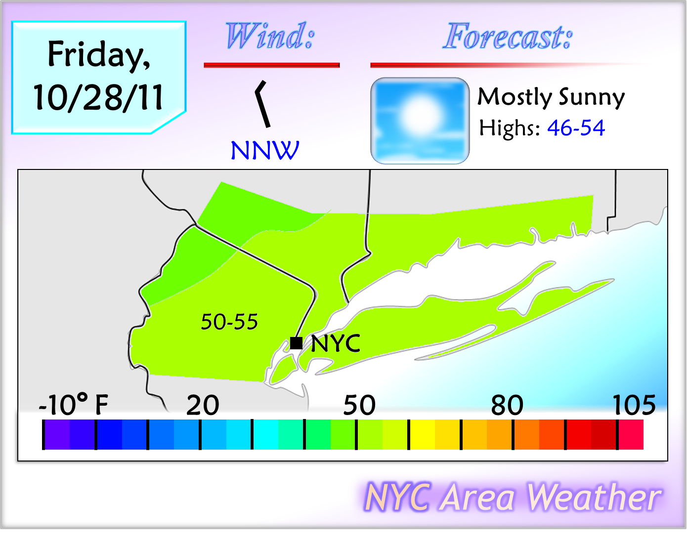
Temperatures are currently steadily dropping across the area, and fell below the 40 degree mark in the interior parts of the area. With clearing skies expected for tonight, low temperatures will drop into the lower to upper 30s across the area with some upper 20s inland, bringing the first widespread frost of the fall across the area. The cold is not the biggest story for this time frame, however, as a strong coastal low developing off the coast and moving towards the region will bring an unseasonably early snowstorm to the region including the NYC area which, if the current expectations are correct, may become historic for this time of the year.
Tomorrow's Outlook:
Saturday - Saturday Night: Early Season Snowstorm Expected
The model performance for this storm has not been very good, as after showing the storm three days ago, the models considerably backed away from showing the storm two days ago, with only the ECM holding on to the strong storm idea. Yesterday's runs brought a slow west trend, but except for the UKMET, the rest of the models kept most of the storm offshore with only light precipitation affecting the coast. Despite the fact that there are only two days left until the storm affects the region, a significant last minute trend took place with the model guidance today, as the models adjusted towards a stronger and further west storm, bringing a significant early season snowstorm to parts of the region.

Forecast for the NYC Area: At this time, I am expecting light rain to begin developing in the area on Saturday morning, mixing with snow in parts of northern NJ/SE NY. The precipitation will steadily intensify, and by Saturday afternoon, a steady moderate/heavy rain is expected for NYC and Long Island, with snow mixing with the rain in southern Connecticut, NE NJ and SE NY, and mostly plain snow falling in the higher elevations of Sussex/Orange counties. By the evening, as the storm starts to move away from the coast and colder temperatures aloft move in, the western parts of the area will change over to plain snow, with a rain/snow mix in the immediate NYC area and southern CT with mostly rain falling in Long Island. The storm will end around 12-2 AM with lingering snow showers across parts of the area.

In NYC, the current scenario would bring a trace of snow with perhaps some light accumulations in the colder case scenario, but even a trace of snow will make this a historic event for NYC; since records were kept in Central Park in the 1860s, only three Octobers brought accumulating snowfall. If the scenario I am currently expecting or a scenario further west verifies, a trace is likely in NYC. If a scenario near today's model consensus verifies, however, this storm may end up as the 4th storm in recorded history to bring accumulating snowfall to NYC in October.
There is still uncertainty with this storm, and the forecast is subject to change. At this time, considering that the models are still trending west, I went with a scenario slightly to the west of the latest model consensus, but the possibility is there that the current models may be correct with their scenario. Depending on the model trends, tomorrow's forecast may either go with a further west scenario, where NYC sees nearly 2 inches of heavy rain followed by back end flakes with a rain/snow mix for Sussex/Orange, or the forecast may reflect a scenario similar to the current consensus, where 3 to 7 inches of snow would fall across northern NJ with some rain in NYC changing over to a mix and a few hours of heavy wet snow, likely accumulating even in the city itself. Stay tuned for more information on this storm with two updates; the first around tomorrow afternoon, and the second tomorrow evening, along with a final scenario and snow map.
Longer Range Outlook: Behind this storm, much colder temperatures will move in, with almost the entire area dropping near or below the freezing mark on Saturday night. Low temperatures are even expected to reach the mid 20s in Sussex and Orange counties. Sunday will bring mostly sunny skies and chilly temperatures, reaching the mid 40s to lower 50s across the area. Temperatures will steadily warm up throughout next week, likely getting into the 60s around the second half of next week. The potential may be there for a storm on Tuesday/Wednesday, which the latest model guidance shows staying mostly offshore but needs to be watched as it may trend further west.
No comments:
Post a Comment
Appropriate and subject relevant comments are welcome. Comments that are non-weather related or contain arguments with no legitimate reasoning to back up their claims are not tolerated and will be moderated and deleted.